An Old Map Could Provide a New Vision for Water Management in the West
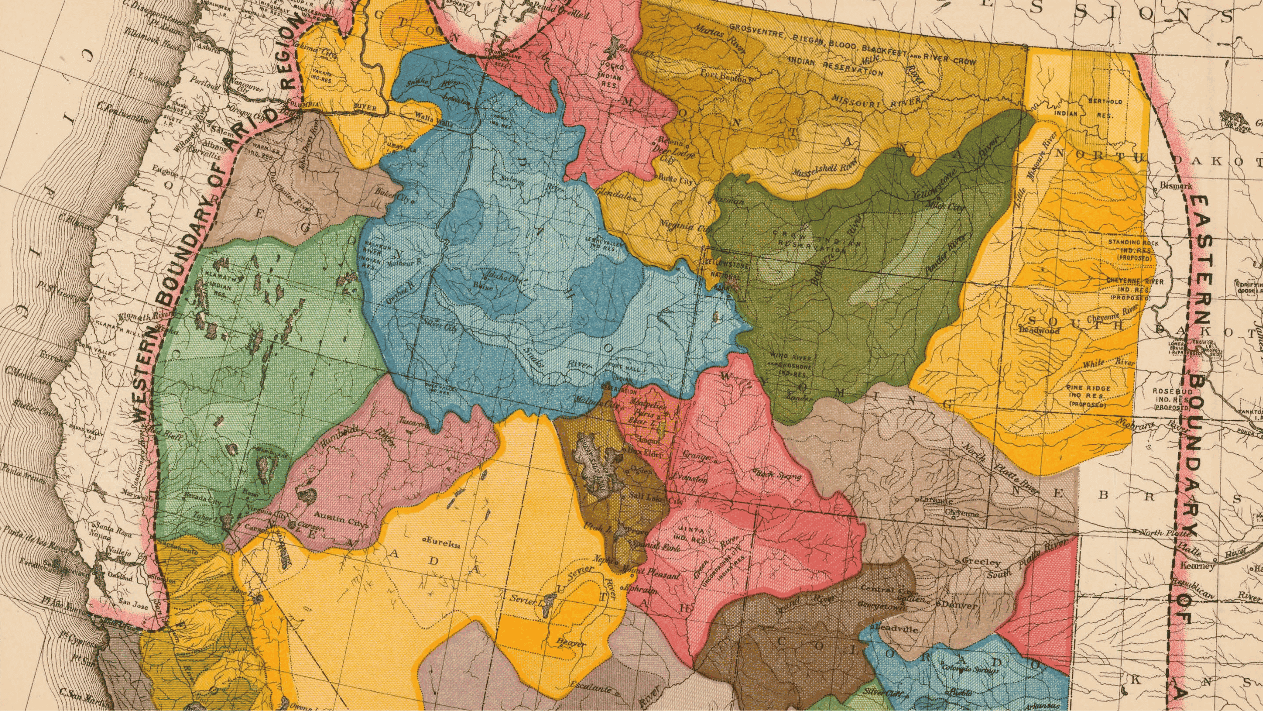
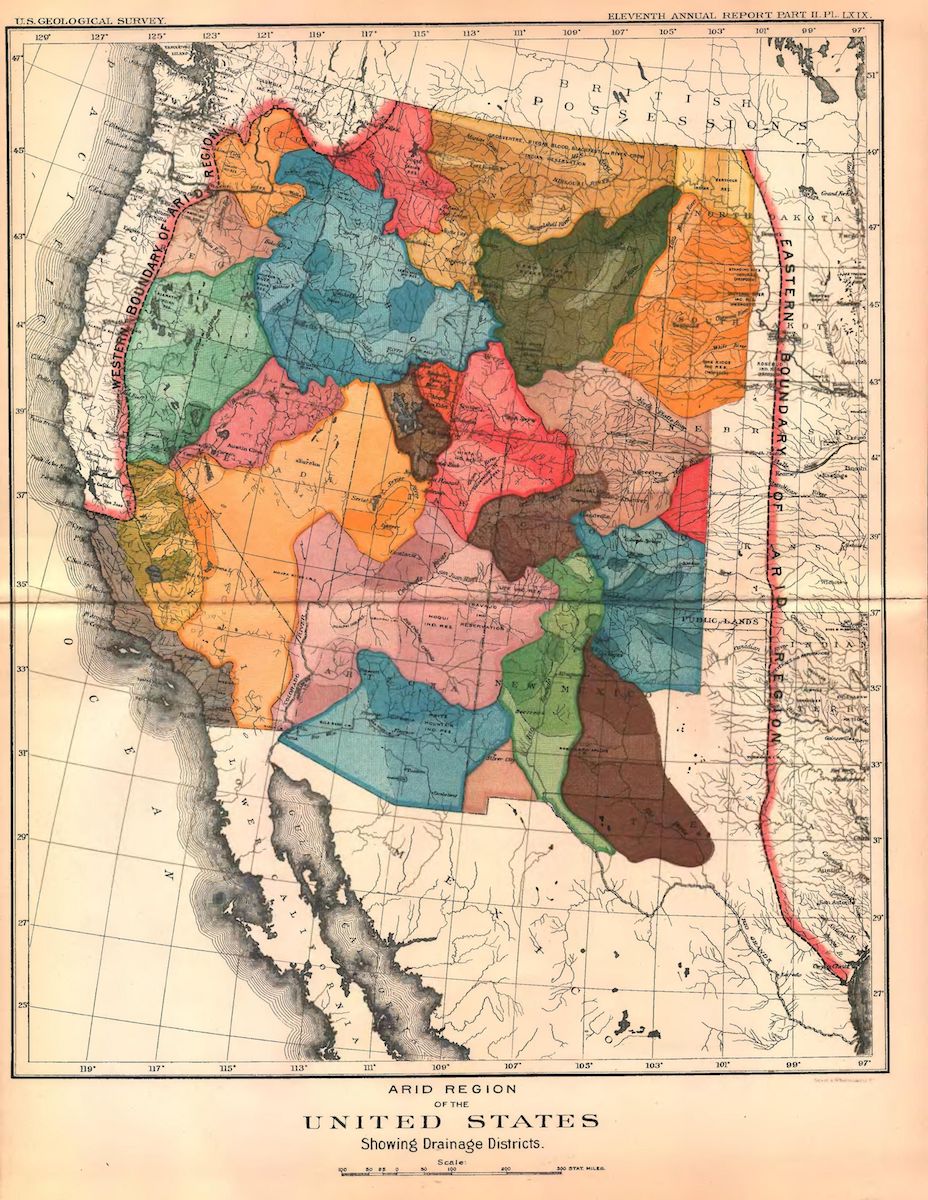
There are a lot of cartographic ways to envision the Colorado River Basin. We now have high-definition satellite imagery that tells us nearly to the minute what the earth looks like. There are the topographic maps built and designed by the United States Geological Survey that use the curvature of lines to denote slope and elevation. There are geologic cross-sections that cut into the earth and show us its sandwiched layers, and hint at the great amount of time needed to make all this stone and rock. But there is one historic map (which we will call Powell’s Watershed Map), consisting of a series of curves, oblong kidneys, and bright colors that might be the most useful in the drought year of 2026.
It is an altogether colorful collection of shapes that was assembled by one of the United States’ great scientific and bureaucratic figures of the 1800’s: John Wesley Powell. Powell, a geologist by training, would become one of foremost experts on the West, its landscape, climate, and peoples.
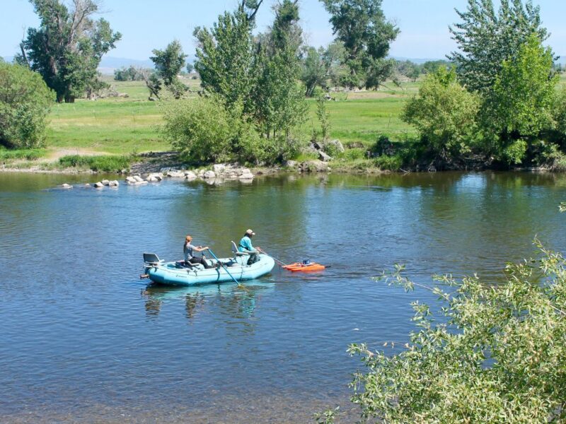
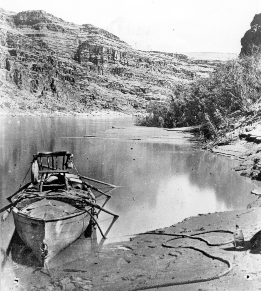
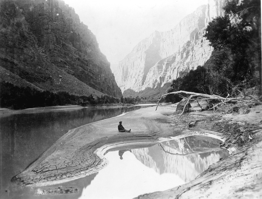
After losing an arm in the Battle of Shiloh during the Civil War, Powell turned his attention to the exploration and mapping of the American Southwest, focusing his efforts on the Colorado Plateau. This quest lead Powell on expeditions crisscrossing the Colorado River Basin and its tributaries, mapping and filling in the “Great Unknown” along the way. He would embark on two river trips down the Green and Colorado Rivers, navigating some of the most formidable and legendary whitewater in the country in Whitehall boats, vessels with curved hulls designed at the time to be the fastest boats on the water, but woefully slow to turn and maneuver, a key feature in any whitewater boat today. Powell would also map the remote Kanab Plateau in Utah, and following his explorations of the West, be appointed the second director of the United States Geological Survey. But one of his most important contributions to landowners in the West today might be that single, colorful map.
It is a technicolor example of thinking differently about the basin. It can also give us a blueprint for how landowners, ranchers, and farmers can survive in the difficult times ahead.
Powell’s Vision of the West
Communicating the values and stories of the West, let alone the unique beauty and power of its landscapes and wildlife, back to the halls of power in Washington D.C. was an immense challenge for Powell and his fellow explorers. But in the years just before Major Powell’s trips down the Grand Canyon a technological breakthrough made that task a bit simpler: the camera.
The promise and opportunities of the West captivated the imaginations of both lawmakers and the public. After the Civil War, the race to map and survey the region was full speed ahead with the United States government funding multiple surveyors to comb the country: Major Powell, Clarence King, Ferdinand Hayden and Army Lieutenant George Wheeler. These men would have enormous influence over the policies and systems under which the settlement of the West would be administered; their competition would inspire bitter rivalries and vastly different visions for the future of the West. Through his Western explorations and study of indigenous cultures, Major Powell developed a unique perspective on the American West that differed from contemporaries like King, Hayden, and Wheeler. He proposed a distinct approach to settlement based on the region’s limited water resources.
The differences were a result of Powell’s breadth of attention, which went well beyond just determining the value of land for mineral wealth, economic capacity, or train passage opportunities. Powell’s interests extended to the people who had long occupied these places: he paid special attention to how they had learned to survive in the harsh and arid landscapes he encountered. But for many western American political leaders, the greater goal was speedy settlement of their states and reaping the economic windfall that westward expansion provided.
As tension grew in the late 1880s between Powell and politicians pushing for rapid expansion, Powell’s USGS team produced the Watershed Map. Tasked with determining the agricultural potential of the arid West, Powell used the map as a key component of his fact-finding mission amidst strong political opposition from figures like Sen. William Stewart and the Senate Select Committee on Irrigation and Reclamation of Arid Lands.
The Lands of the Arid Region
The work that led to the creation of the Watershed Map was not Powell’s first time contemplating the capacity of the American West to support agriculture. In fact, his 1877 opus Report on the Lands of the Arid Region of the United States Powell had grappled extensively with the complexities of developing agricultural production in the American West.
The conclusion he reached in his report was that traditional Eastern agriculture was not viable in the West: “To a great extent, the redemption of all of these lands will require extensive and comprehensive plans, for the execution of which aggregated capital or cooperative labor will be necessary. Here, individual farmers, being poor men, cannot undertake the task. For its accomplishment a wise prevision, embodied in carefully considered legislation, is necessary,” he wrote.
The 1889-1890 Irrigation Survey was responsible for identifying not just irrigable lands, but reservoir sites, stream-gauge stations, and other important water monitoring tools. From the summer of 1889 to June of 1890, Powell’s men were responsible for discovering 147 new reservoir sites across the West, but those sites only were projected to irrigate only a small fraction of the potentially irrigable lands in the West.
In the late 19th century, America was an agricultural land. Agriculture was the biggest employer and the nation’s identity was formed by Jeffersonian ideals about the ability of small farmers to own a patch of land, improve it, and be self-sufficient. In wetter areas, 160 acres worked as an allotment of land for farmers and their families. In arid areas like the American West, that was a woefully insufficient allotment without irrigation to make the desert bloom. Powell’s survey, with its hard facts and scientific measurements that dramatically advanced what was known about the region, was coming up against the long-held belief that “rain follows the plow” and Jeffersonian agriculture’s capacity to improve the land.
Powell was determined to show the Senate Select Committee on Irrigation and Reclamation of Arid Lands that his vision was the one that should guide their decisions about land use for the American West. His future of the West included collective settlement and political divisions based on geographic realities. What happened instead would sow the seeds for our current crisis in the Colorado River Basin. Powell’s suggestions ran aground in front of powerful Western senators, and their railroad industry patrons, whose political and economic ambitions were clear: For the settlement of the West to be popular and profitable, it would have to look like the settlement in the East, complete with 160-acre homesteads for the sons and daughters of Jefferson.
What Would Powell Have Done?
The political machinations that sunk Powell’s hand were complicated, but Powell’s assessment of the readiness of the western United States to undergo intensive eastern-style agriculture was not. He believed only about 3% of the American West was readily irrigable and that small farmers were not well-capitalized enough to buy enough land or build the necessary water infrastructure to grow crops at an economical scale. Instead, Powell believed agriculture in the West could only be accomplished through state-sponsored communal irrigation districts in areas close to existing waterways, with the rest of the land reserved for communal grazing allotments.
But the Watershed Map was probably the biggest swing he took. Powell thought these divisions were the lines within which water should be managed, encouraging collaboration and local control. Powell believed that managing water and lands in the West along any other divisions would be “piling up a heritage of conflict and litigation over water rights, for there is not enough water to supply the land.”
In fact, this prediction would prove to be prophetic, even before climate change severely reduced the amount of water available. As early as the 1920s, many waterways across the West were already facing overallocation under prior-appropriation water allotment systems, and the United States Supreme Court had been asked on numerous occasions to intervene in water conflicts. Disregarding the advice and data of scientists like Powell would prove to be a recurring issue for the Colorado River. The 1922 Compact negotiators also disregarded the warnings of scientists that they were allotting more water than existed in the Basin. The difference in states’ water laws and individual water allotments instead of collective allotments has created a series of headaches for water managers looking to conserve water across these invisible political divides. Water does not follow straight lines, nor does it recognize human fictions like “upper basin” or “lower basin.” Managing for the watershed was what made sense to Powell because in his view managing for the watershed would reduce the opportunity for large-scale system failures, in turn reducing the opportunities for conflict.
Powell’s experience as a geologist, surveyor, and scientist caused him to think differently about the American West. But his thinking has somber resonance today, particularly for landowners, ranchers, farmers, and water managers across the Colorado River Basin.
In whatever new agreement is drawn up by the seven states and federal government, there needs to be an understanding that landowners shoulder a remarkable responsibility for keeping our ecosystems whole and healthy, and working collaboratively with them must be central to any solution.
Old Ideas for New Problems
How can we move forward in a time of aridification when the legal and political tactics clash against reality on the ground, leaving landowners stuck in the middle? Powell’s suggestions from the late 19th century offer the modern West a water management regime wholly different from today’s legalistic system; one focused on collaboration and mutual sacrifice over conflict.
Landowners, particularly those with agricultural water rights, are central to adaptation and mitigation in the Colorado River Basin. They also stand to lose the most if nothing is done. By thinking outside of state lines and viewing water management through the natural lines of watershed basins, other changes follow. Acknowledging that we need new governing procedures and bodies to handle water in the West is a clear starting place—Powell’s map shows us what that could look like.
Making it possible for small-scale farmers and ranchers to graze and grow food and fiber is important, as is acknowledging that certain lands are not going to offer the flexibility or capacity to do those things. Accepting the limitations of the land and climate is necessary for the basin’s survival, a bare minimum reality check. Opportunities for local control interconnected to the larger system are a way forward: smaller irrigation collaboratives and grazing groups have shown us that working together is possible, but the barriers in current water management structures limit the viability and impact of these collaboratives. Water law in the states has been slow to adapt, and the possibility of adapting to the changing climate through shortage sharing is prohibited in many areas.
In whatever new agreement is drawn up by the seven states and federal government, there needs to be an understanding that landowners shoulder a remarkable responsibility for keeping our ecosystems whole and healthy, and working collaboratively with them must be central to any solution. These management decisions can take many forms, from assisting landowners to return to native plant species on marginally productive agricultural land, to addressing the engineering limitations of current infrastructure to maintain operational flexibility, to developing shortage sharing management in bad years.
“We have an unknown distance yet to run, and unknown river to explore. What falls there are, we know not; what rocks best the channel, we know not; what walls ride over the river, know not. Ah, well! We may conjecture many things. The men talk as cheerfully as ever; jests are bandied about freely this morning; but to me the cheer is somber and jests are ghastly.”
– Major John Wesley Powell, from his journal during the first expedition down the Colorado River, August 1869.
Thomas Plank, WLA’s Colorado River Basin Communications Coordinator, contributed to this story.