Science! Fish! Irrigation! with the Henrys Fork Foundation
If you aren’t a fly fishing sicko, you might not be familiar with the Henry’s Fork in eastern Idaho. This place is a trout’s dream, with an incredible amount of insect and aquatic life that gets these fish to grow big, and get very, very picky. The Henry’s Fork sits in some of the most productive irrigated agricultural land in the American West (Idaho potatoes are famous for a reason!) And there is certainly tension between these two main economic drivers of the American West: recreation and agriculture. That’s where the Henry’s Fork Foundation comes into play.
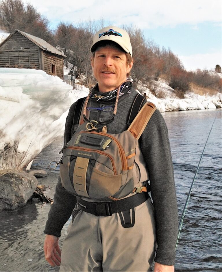
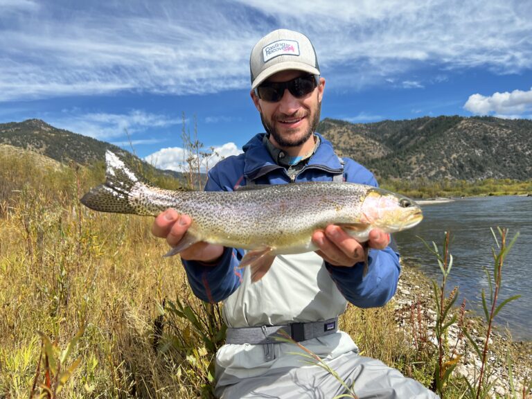
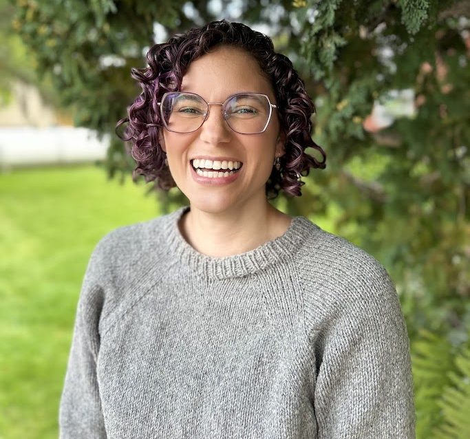
In today’s episode, we talked with three HFF science team members about how science, landowners, and conservation can work together. Thanks to Dr. Rob Van Kirk, HFF’s science and technology program director, Dr. Jack McLaren, aquatic ecology program manager, and Dr. Christina Morrissett, climate adaptation program manager, for joining us!
Listen
Links from this episode
The Henry’s Fork Watershed Council
Rural Communities and Place-based Collaboration
CREDITS
Thanks again to Rob, Christina, and Jack for joining us today. You can learn more about the Henry’s Fork Foundation’s work at the link in the show notes, which you can find by heading over to onland.link/podcast
On Land is a production of Western Landowners Alliance, a West-wide organization of landowners, natural resource managers and partners dedicated to keeping working lands whole and healthy for the benefit of people and wildlife. This episode was hosted by me, Thomas Plank, and produced by Zach Altman.
If you enjoyed this episode, share it with a friend, leave a review wherever you get your podcasts. Your support helps us amplify the voices of stewardship in the American West. Thanks for being here. We’ll see you next time.
Transcript
Rob Van Kirk: [00:00:00] We have this job of trying to recreate this, you know, unparalleled sort of tailwater supercharged spring creek fishery in a world that’s warmer and we have less water to work with. And that’s why Christina and Jack are here, is to solve that problem
Thomas Plank: Welcome back to On Land On Water with me, Thomas Planck. If you aren’t a fly fishing sicko like I am, you might not be familiar with the Henry’s Fork in eastern Idaho. This place is a trout’s dream, with an incredible amount of insect and aquatic life that gets these fish to grow big and very, very picky. The Henry’s Fork sits in some of the most productive irrigated agricultural land in the American West. Idaho potatoes are famous for a reason, and there is certainly tension between these two main economic drivers of the American West: recreation and agriculture. That’s where the Henry’s Fork Foundation comes into play. I sat [00:01:00] down with part of the science team at the foundation, which is a watershed conservation organization that uses science-based collaboration to preserve the Henry’s Fork fishery. Rob Van Kirk, Christina Morissette, and Jack McLaren are core components of the foundation’s greater goal of using science and data to keep this incredible resource alive and thriving
Rob Van Kirk: My name is Rob Van Kirk. I, uh, am the director of our science and technology team at the Henry’s Fork Foundation. Um, I’m the old guy in the, in the room, I guess, here. Um, I started fishing river in 1977, and I worked in the fly fishing business, uh, for Henry’s Fork Anglers, one of the longtime outfitters here on the river, uh, throughout most of the 1980s.
And I started working for the Henry’s Fork Foundation in 1994. Uh, [00:02:00] worked for four years, then I was a university professor for 14 years and then came back to the Henry’s Fork Foundation, in 2013. I guess I’ve been here now, whatever that is, 13 years, um, consecutively. More or less, though, my entire professional career has had the same, um, research arc, and that is, uh, studying water, hydrology, uh, how water is managed, and interaction of water management and fish and aquatic resources, uh, in the Snake River basin.
So I’ve been doing that, you know, continuously now since 1994.
Christina Morrisett: Hi everyone. My name is Christina Morrisett. I am the climate adaptation program manager at the Henry’s Fork Foundation. I joined HFF in 2015 as a 10-week summer intern, and that was over 10 years ago. Uh, I came out here to learn about fish, and I ultimately ended up sticking around for water. Um, uh, in my role now, I [00:03:00] think about analyze, anticipate, adapt, analyzing climate and water data to anticipate short-term and long-term futures to help everyone from individual anglers to guides and outfitters to farmers to communities adapt accordingly
Jack McLaren: Uh, yeah, my name’s Jack McLaren. I’m the Aquatic Ecology, Aquatic Ecology Program Manager for the Henry’s Fork Foundation. Um, like Christina, I’ve been around in some capacity since about, uh, 2015. Um, I was working for Idaho Department of, uh, Environmental Quality back then. But, uh, in 2016, I was a graduate student intern for the Henry’s Fork Foundation, and I’ve been– essentially, my entire career has been with the Henry’s Fork Foundation since then in various capacities as graduate student, um, well, master’s student, and then a PhD student, uh, and then as my current role.
Um, and, uh, what I focus on is, uh, taking our, our long-term, uh, monitoring or the data that we [00:04:00] collect across our entire watershed, which is pretty extensive, um, and then thinking about what limits, uh, fisheries production, the, the things that we care about in the, in the Henry’s Fork watershed, those, uh, unique, uh, fisheries and aesthetic qualities of the Henry’s Fork watershed that we work to conserve and, and thinking about things in a, in a big picture and understanding, you know, what are some of the knobs that we can turn from a conservation point of view, uh, in order to have a positive impact on those resources in the watershed
Thomas Plank: Awesome. Thank you guys. Uh, and then the next question is, what is the Henry’s Fork Foundation? Which I guess the better question is, what is the Henry’s Fork? And then we can go into why the Henry’s Fork Foundation exists
Rob Van Kirk: I’d be happy to start with the Henry’s Fork part, and then I … That’ll tee up Christine and Jack, I think, to talk about the organization and why we do what we do. So, um, [00:05:00] the, the Henry’s Fork, uh, it’s also the North Fork of the Snake River. Um, so it’s one of the two major forks. And, uh, it is, it is unique in the sense that it’s a giant spring-fed stream.
Uh, it originates from a large number of springs, uh, at the base of the Yellowstone Plateau, so kind of on the west and southern edge of the Yellowstone Plateau. And in fact, there are three streams that are just full-blown rivers right out of the ground, Big Springs, Buffalo River, and Warm River, uh, putting in a combined 600 cubic feet per second into the Henry’s Fork just, just right out of the ground.
So it’s, it’s a world-class, um, spring system because of the unique geology of the Yellowstone hotspot. The, the fishing experience that’s created as a result of that is also unique because you have this, uh, river that’s in places 100 yards wide, two feet deep, [00:06:00] and with a gravel bottom. So it’s just perfect for, all kinds of mayflies, caddisflies.
Uh, and so the, the, uh, hatches are really what made this river famous. And then those flat reaches are punctuated by these narrow canyons with rapids and bedrock geology and waterfalls. And in those reaches, it’s stoneflies, um, that are the, the, um, aquatic insect species. So people come here from all over the world to, um, to fish for rising fish in this flat, you know, spring creek type environment.
To, to get to why … what we do and what the Henry’s Fork Foundation does, we have 80 miles of, of great trout water, uh, as is the subtitle of a book written by Mike Lawson, who was the, the founder and current general manager of Henry’s Fork Anglers. That’s the outfitter that I work for. [00:07:00] Um, but, uh, within that 80 miles, there’s about 15 miles that really are the core of why this river’s famous, and that’s 15 miles, immediately downstream of Island Park Dam.
Uh, that’s, that’s a dam that, uh, stores irrigation water for the, the local irrigation district. What Jack was talking about earlier about taking our long-term data and trying to figure out what factors limit the fishery, what factors limit fishing experience, what we’ve learned is that when water supply is really good, as it was, say, between the mid kinda late ’60s and the late ’90s, Park Reservoir actually acts like you would think a big, deep reservoir would act.
And so we had this spring creek that was actually supercharged by this reservoir producing very consistently high flows of cool water all the spring, summer, and fall, which kept the aquatic [00:08:00] insects, insect hatches very consistent. It produced exactly the species that anglers like, pale morning duns, green drakes, that sort of stuff, produced the, the great fishery that the Henry’s Fork was known for.
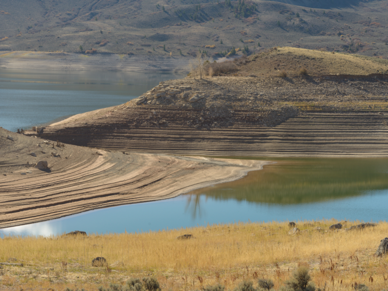
When water supply is low, as it has been in the past 25 years, Island Park Reservoir has the opposite effect. It creates lots of dirty, warm water with a large degree of fluctuation in flows between really low flows in the winter when the reservoir’s being filled, to proportionally very high flows during a short period of time during irrigation season, which also coincides with fishing season.
So we this job of trying to recreate this, um, you know, unparalleled sort of tailwater supercharged spring creek fishery in a world that’s warmer and we have less water to work with. And that’s why Christina [00:09:00] and Jack are here, is to solve that problem. So I’m gonna kind of hand off to you two to, know, talk about how that setting of the Henry’s Fork and its fishery, um, translates into what the Henry’s Fork Foundation is and how we work.
Christina Morrisett: Well, I guess I’ll kinda keep flowing us down river, right? So the river comes out of the mountains at Big Springs, it flows, it, it, and then it, it accumulates in a reservoir behind Island Park Dam. Some of that water is released downstream, it flows, it goes over Mesa Falls, and then it meets the Snake River Plain, where we have these big agricultural, uh, fields.
Um, and we’ve had those fields for the past 100-plus years. And so we operate in, in a regulated watershed. We operate in a space where every drop of water is allocated to a water right for irrigation. And so, um, we kinda talk about sometimes how the Henry’s Fork fishery is a little bit of a happy accident, uh, r- relative to, [00:10:00] uh, this r- highly regulated system.
And so, uh, our organization was founded in 1984 by a group of concerned anglers, um, concerned about what they were seeing in the river. And what we do and how we operate is we are science-based and we are collaborative. As an organization, we have no water rights. We have no water management authority.
All of that is, um, by the State of Idaho and the irrigators in our area. And so we could not do the work that we do without collaboration. So we really strive to bring, uh, river-specific solutions, to bring data to the table, to find win-win solutions for the fishery that doesn’t harm the farming foundation of the community that we work in.
Uh, and so, uh, I think that’s really where the Henry’s Fork Foundation shines and in terms of our strength is recognizing that we’re not gonna be able to be successful as an organization without those partnerships, without that collaboration in the system that we work in. And so we really seek to leverage the data that exists in the system, [00:11:00] uh, having scientists be able to look at that data and find, and find solutions.
So we aren’t just bringing values to irrigators, but we’re bringing database solutions, um, to figure out how can w- water be managed in a way that works for farms, fish, and the fishing experience.
Jack McLaren: Yeah, I think, uh, I think they covered it. I mean, the on- only thing I can add is, uh, is it’s a beautiful place. I mean, I think that, uh, um, it’s… It, it, Rob mentioned, you know, 80 miles of, of river to fish, uh, that are, you know, really good trout fishing waters. And, and, and what I love, you know, what, what really made me fall in love with the Henry’s Fork watershed when I first came out there was, was how different each reach of river is.
It, it’s, it’s not the same… It’s a radically different river from where it starts to where it ends. You, you’ve got, um, a really interesting like lake run salmon and, and, and trout fishery upstream of Island Park Reservoir. And once you get downstream of Island Park Reservoir, [00:12:00] you’ve got this, you know, couple miles of, of, of a canyon kind of tailwater fishery through this spectacular black, you know, columnar basalt canyon, um, with rapids and fast water and so forth.
And then it exits that canyon and, and flows through this spectacular open caldera. You know, you’re, you’re, you’re inside an old extinct volcano essentially, and, and the river meanders through that. No trees, you know, great flat water fly fishing for, for dry… You know, you kind of have to use dry flies.
It’s, and this, you know, us fly anglers get, get maligned as being, uh, I, I don’t know, snobs or, or like, like, you know, this dry or die kind of mentality. But honestly that stretch of river, you kind of have to use dry flies, otherwise you’re, it’s, it’s too shallow. There’s too many, uh, too much aquatic vegetation.
You’re just, you’re, you’re gonna be snagged. You’re not gonna get bit. Uh, and then it flows through another spectacular canyon. Then it’s out onto the Snake River Plain, and then the further you get out on the Snake [00:13:00] River Plain, it starts becoming a gravel bed river, kind of like what you would see on the Madison or the South Fork or something like that.
It’s just, it’s incredible. I mean, every float on the Henry’s Fork is, is, it’s as if you’re floating a different river. Um, the species of fish that you can target change, the hatches change. It’s, it’s, it’s, and it’s, it’s, um, in a beautiful part of the world as well. Even when you’re floating down on the, you know, if you’re fishing and floating down on the, on the lower part of the, the Henry’s Fork River, it’s, you’re…
It’s not like you’re just floating through farmland in a lot of ways. You’re kind of still down in a little canyon, and it’s easy to, to forget that you’re not in the mountains anymore. And then you’re floating, you’re still floating through spectacular, intact riparian zones in a lot of areas, and all the birds and wildlife and moose and, and all this stuff.
It’s, it’s an amazing place. I, I, I love it. I couldn’t be happier to be in a place to, to try to conserve, so
Thomas Plank: Rob, I was making a grimace during your talk about two feet deep, all [00:14:00] gravel, 100 feet wide, because that just made me think of 7X liters and size 22s. So yeah, as, as another fly fishing sicko, I get it. And also the Henry’s Fork is a frightening place to consider visiting because I’m like, good presentation? Who, whoever would have thought of that? Come on. Um, okay. So thank you guys for explaining that and kind of giving us a rundown of what the Henry’s Fork is, why it’s important. Christina, in our conversation a couple of weeks ago, you mentioned a $50 million fly angling industry that’s sprung up around this, and also a $10 billion agricultural industry that’s also fed by this. And I mean, you know, different level of magnitude there, but it’s also very clear, I think for anybody who lives in the West, that recreation and irrigation are very, very tightly interconnected. Um, and I think one of the things that Western Landowners Alliance really focuses on is [00:15:00] this collaboration between landowners and scientists and conservation all kind of coming together.
Um, I’m curious if you guys have any particular stories of collaboration that really kind of spring out or that, you know, reading some of the work that you guys have done and going through some of these papers, if there are any particular studies that you’ve done that are, you know, more or less indicative of the kind of work that you guys are doing.
Um
Rob Van Kirk: Le- let me… I’ll, I’ll start by at least talking about the, collaboration part and, and our signature sort of collaborative effort, and then I’ll hand that to Christina. But it, like many places around the West, um, watershed have es- been established and been successful at promoting collaboration, um, our, our…
We have a watershed council, Henry’s Fork Watershed [00:16:00] Council, that is co-facilitated by the Henry’s Fork Foundation and Fremont-Madison Irrigation District, and Christina is currently, uh, our co-facilitator, uh, of that organization. But like many of these groups around the West, it, it was formed of, um, conflict and a, and a sort of precipitating event.
You know, and I, I think about, for example, um, I think in, in the Big Hole drainage just, you know, on the other side of the divide here, it was a listing of arctic grayling that was, uh, that was an event that precipitated formation of their watershed group around the same time we formed ours. Um, and it was a, it was…
That was an event that, that had, uh, that brought threats to water users and to, uh, ranchers and to the outfitting and guiding community because like the Henry’s Fork, the majority of our fishery is built around non-native fish. And so I know in the Big Hole f- drainage, for example, guides and [00:17:00] outfitters were concerned that maybe listing of a native species would preclude their, um, business built around fishing for non-native species
Thomas Plank: If what Rob just said rings a bell, have we got some great stuff for you. WLA has covered the work the Big Hole Watershed Committee has done. Former guest and WLA’s director of the Working Wild Challenge, Eric Kalsta, has been instrumental in that organization and paid particular attention to the Arctic grayling.
Check out the links in our show notes if you wanna learn more about this topic
Rob Van Kirk: So our precipitating event, uh, occurred in 1992, uh, and it was a, a complete draining of Island Park Reservoir, uh, partly due to irrigation demand. It was a, it was a dry year and the, and the reservoir was, was, uh, drained at pretty low level for irrigation. But then, uh, Idaho Department of Fish and Game, uh, thought, “Well, as long as the reservoir’s low, we may as well treat it for non-game fish,” which was the rule [00:18:00] back then, you know, in the, in the, gosh, what?
1950s, ’60s, ’70s, ’80s, ’90s. And, um, so Fish and Game said, “Well, let’s just go ahead and drain it to the bottom, then we’ll treat it for, uh, non-game fish.” And the process of lowering the reservoir, especially that last, 5% to 10% of the reservoir volume, mobilized a large amount of sediment that had accumulated on the bottom of the reservoir, um, as a result of the 1988 Yellowstone fires and some long-term, um, you know, just land use practices of the day.
Uh, that introduced 50,000 to 100,000 tons of sediment into the river, uh, as a result of that event. And it was one of those things where it didn’t look good for the irrigators. They’re generally sort of neutral on things like water quality, but it certainly wasn’t a good look for them. It’s never a good thing for the irrigators when the reservoir’s drained to the bottom.
Uh, and it was [00:19:00] even a worse look for the agencies, and I think what grew out of that was just a realization that we had a large number of different state and federal agencies that have some little jurisdiction over some portion of the management of the resource. Um, and they didn’t communicate with each other, and this, this event happened.
So the Watershed Council was, was– Our Watershed Council was born out of, how can we do a better job of collaborating, of using science, of, uh, informing each other, of working together? And so the– the, the course of 1993 and early 1994, a group of folks met to establish the Watershed Coun- Watershed Council.
It was chartered by the Idaho Legislature, uh, in the 1994 legislative session, and we’re still operating under that same, uh, charter today. And as I said, Christina is the current, um, facilitator from HFF
Christina Morrisett: Yeah. So today, [00:20:00] um, the Henry’s Fork Watershed Council, we meet just kind of practically six to eight times a year. Uh, we have half-day meetings. We come together to just talk about the latest research, the latest projects, the latest operations updates happening in the watershed. Uh, so that can be presentations from state and federal agencies, from NGOs, from consulting groups, from university researchers, just to keep everyone abreast of the latest topics and conversations.
Uh, we might have presentations, we might have panels. Uh, and then we also have an annual t- field tour in August, where we actually get out on the land and look at everything that we’ve been talking about or a key project of interest. And it’s, it’s interesting reading back on kind of the meeting minutes or conversations from th- those early years where they talk about…
There’s this one article that talks about meeting in a farmhouse, uh, being surrounded by axes, and having that, that be like this like moment of tension in the room, um, because it was very farms versus fish and how are we, how are we having these [00:21:00] conversations. And today, we are very much standing shoulder to shoulder.
Everyone knows everyone in the room. I, I feel like it’s a very inclusive, um, environment. Um, and, uh, and we all know each other, and we’re neighbors, and we’re community members, and we’re able to have these hard conversations, ask these hard questions. Um, and yeah, it’s, it’s cool to be a part of. It’s, uh, been around, right, for 30 years, th- uh, 30-plus years, and, uh, I think that’s kind of o- one of our key collaborative pieces is the Henry’s Fork Found- is the Henry’s Fork Watershed Council.
Thomas Plank: In our minds, collaboration is the best form of conservation. From wildlife conflict mitigation to building sturdy rural communities, collaboration is a bedrock belief at WLA. For more on what this looks like in action across multiple kinds of conservation efforts, check out the links in our show notes. Thank you. Um, Jack, would you mind giving us a description of how you guys are collecting data around the Henry’s Fork, what that looks like, what you’re actually [00:22:00] looking for, and what you’re tracking over time? And then I think from that, we’ll probably jump into some of the research that you’ve been doing.
Christina talked about that paper and just looking towards the future, because I think for this particular topic, I’m interested in, like, you guys have done all this great work. It’s been going on for 30 years, but you’re also looking at a drying climate, some definite shifts as we’ve seen in the last few years just based on snowpack and how things are going.
But, um, that’s kind of where I’m thinking. But Jack, I’ll throw it over to you
Jack McLaren: Yeah, we collect a lot of data. Um, we c- collect a lot of data. Um, a lot of that data is available on our website as well. So we do a lot of work to, to both collect the data and then make it available for, uh, the public. And, and that kind of ties into what Christina was talking about earlier with the Watershed Council as well.
It’s, it’s a good thing to collect all this data, uh, but we need to be able to share it and get that information out there and, and get it out there to our, to our partners, um, especially management partners, if we wanna [00:23:00] have any hope of, of making the data-based decisions that, um, you know, these … Trying to find these win-wins is only possible if, if, if you can find one win for the fish and then communicate that with management partners and farmers and ranchers and that kind of thing, and, and they tell you, “Oh, well, this is what would work for us.”
So that’s kinda how that works. So, um, the data that we’re collecting is, is mostly water quality data. We have … What is it now, Rob? Like 13, um, sons, uh, which are these multi-parameter water quality instruments. Uh, I wish I was in the office so I could, I could show one. But they’re these, these long cylindrical kinda tube-shaped devices that, uh, live inside of a PVC housing, uh, usually bolted to, uh, a, a, a bridge piling or a, a big chunk of lava rock or a, a canal headgate of some sort, some kind [00:24:00] of
Something that we’re reasonably confident is not going to move during a, a flood or, or irrigation releases or whatever. Um, so it stays in place and it … that, that collects, uh, temperature, dissolved oxygen, conductivity, um, turbidity. Um, and then we do, uh, uh- wa- like grab samples as well for total phosphorus, total nitrogen, uh, suspended sediment concentration.
Um, and we do that weekly. And then our sondes, which live in the water, um, full-time, are collecting their data every 15 minutes. Um, so we have this long-term, we’ve been doing this, uh, there are some locations that we’ve had a sonde in the water since 2014. Um, and we’ve slowly been iterating and upgrading the different locations where we have these instruments in the water to the point where now almost all of them, I believe, are, are transmitting in real time.
So we [00:25:00] can look at data, um, as it’s collected, uh, which is a, a really valuable, um, thing. So if there’s, uh, some, uh, you know, rapid change in flow or, uh, some change in, um, in conditions, or if something breaks, we can, we could know about it right away. And, uh, and it’s also really valuable from an angler’s perspective too because if you’re curious about whether or not, uh, some stretch of the Henry’s Fork is fishable on a given day, uh, given runoff or high water temperatures, you can check that information in real time on our, on our website and say, “Hey, you know, this stretch of river downstream of Ashton Dam has a lot of turbidity right now because there’s runoff happening.
You know, maybe we ought to go fishing further upstream, uh, just downstream of Island Park Reservoir. The water’s clearer up there,” or vice versa. Um, both of those things can happen pretty often. Um, uh, we [00:26:00] also do a lot of, uh, um, projects like snorkel surveys to understand what kind of habitats do, do trout or whitefish or, uh, uh, you know, what, what they prefer.
Um, tha- that’s been going on long before I was part of the Henry’s Fork Foundation. We’ve done telemetry studies, yeah, snorkeling studies. We work with Idaho Department of Fish and Game, uh, pretty extensively, of course, electrofishing surveys to get a sense of, of, um, uh, fish populations, fish population size, demographic structure.
Uh, we operate two, uh- Fish ladders, one of which, uh, we operate a fish trap on the ladder so we can, uh, collect information about size, uh, number of different species of fish that are using that fish ladder to move into a tributary called the Buffalo River to spawn. Uh, we can estimate, you know, about how much of those fish in the population of the Henry’s Fork are using the Buffalo River to spawn, [00:27:00] and how much that contributes to the population.
Um, and then we do a lot of, uh, sampling on Island Park Reservoir as well. As, as Rob and Christina have sort of already alluded to, Island Park Reservoir is kind of the center of our universe in terms of, of water quality, fisheries, and, and of course, uh, the, the water storage and supply for the, you know, multi-billion dollar agricultural industry further downstream.
Um, so understanding how Island Park Reservoir works is really important for, uh, not just, uh, water quality, but also that, the irrigation storage and, and supply further downstream too. So we, we, we go out on Island Park Reservoir every week when it’s not frozen, and, uh, collect water quality profiles from the surface of the water all the way down to the, the very, uh deepest point in the reservoir at, at various points, uh, in that reservoir to, to [00:28:00] get an understanding of, uh, you know, what’s going on with algae blooms, uh, temperature, dissolved oxygen.
Uh, we did a, a big study on the nutrient and, uh, dissolved metals in the reservoir this past year to get a sense of, of what, uh, kind of management interventions, uh, might be possible and, and what those benefits might be on Island Park Reservoir. Things like, um, aerating the reservoir with pure oxygen or, uh, changing how the infrastructure on the dam operates, uh, so that we can improve water quality, improve fish habitat, improve, uh, the, the fishery going downstream while still maintaining the, the, uh, water supply for irrigation downstream, as well as there’s power generated on Island Park Dam as well, and making sure that, that we can find these, not just win-wins, but win-win-wins, uh, at that particular [00:29:00] location.
So that’s just a sampling. We’ve, we’ve been e-expanding ever since. We do some work over on the South Fork of the Snake River in this, in the same vein. Um, yeah, uh, we do, uh, every spring we take, uh, invertebrate samples in the river. I, I could probably continue on for as I’m sure I’m forgetting some things.
We, we do a lot of work as, as the, the moral of the story, and we’ve been doing it for a long time. At this point, we’ve got 10-plus years’ worth of data, and that’s really been, uh, we’re really able to, to say with a high level of confidence, you know, we understand how the Henry’s Fork works, we understand how Island Park Reservoir works, we, we understand the ecology and the hydrology and the geology and the fish habitat and on and on and on.
A-and now it’s just a lot of it is a question of understanding, okay, what are the limiting factors that are holding back things from, uh, you know, f- holding the river back from operating like people expect it to, both from a fishing and from a water supply [00:30:00] perspective? And how do we go about fixing any problems that might have come up as the world continues to get warmer and, and drier, and we’re experiencing that, that, uh, that reduction in water supply over the course of the past 25 years?
Thomas Plank: Yeah. Watersheds are extraordinarily complex. Rob, were you about to say something?
Rob Van Kirk: Yeah, I’ll just jump in a m- a minute here, Jack. Uh, yeah, 13, uh, water quality sondes in the Henry’s Fork and its tributaries. No, 14. We added one on the Teton. 14 plus three, plus three on the South Fork Snake, so we have a network of 17. And I, I should also just take the opportunity to mention, this is only half of our science and technology team that you’re talking with today.
there are three other folks, um, Joe Hively, who’s our lab and field coordinator. He’s actually out this morning, and [00:31:00] it’s eight below zero, and he’s, uh, maintaining sondes and pulling them out of the river for calibration. So he does all the field and laboratory work, um, collects all those water samples that Jack, uh, mentioned, keeps the, the network running.
Uh, we have a data manager, Melissa Mooradian. Jack said, you know, these sondes are recording data every 15 minutes, and you have a, you know, 14 or 17, whatever it is, sondes out in the river, um, collecting data every 15 minutes. That is an enormous amount of data to, to, uh, QA/QC, filter, manage, archive, to the website, and Melissa, uh, does all that work.
That’s her job as a data manager. And then, uh, we also have Matt Hively, who’s our aquatic resource manager, who kind of deals with the regulatory aspects, kind of more of a, a traditional sort of, uh, position you’d see in a conservation organization versus the rest of us that [00:32:00] are kind of non-traditional as conservation organizations go.
But Matt’s the one who pays attention to, for example, county planning and zoning, undertakings, goes to meetings, gives public comment, is engaged in things like stream channel alteration permits and water right application review, that sort of stuff. So, so he’s… If anything, he’s the one who kind of you would expect in a, in a group like ours, and the rest of us are a little different than what you’d expect.
But anyway, I wanna give them plenty of credit here because we couldn’t do all this stuff without them, um, working hard out on the ground, uh, every day.
Christina Morrisett: And I guess I’ll add, add onto that. When we, with the Henry’s Park Foundation, when we think about landowners, we’re thinking about water rights holders. And so where we find a lot of collaboration there, for example, is through our Farms and Fish program led by Daniel Wilcox, uh, where he’s working with individual farmers to figure out how can we improve your soil health?
Uh, how can we work together to, uh, introduce a new cr- [00:33:00] crop rotation or a new crop product? Um, how can we l- l- looking at voluntary irrigator-to-irrigator water leases, um, and forbearance agreements. And so that is… And then so right, we have our Farms and Fish program working with individual farmers on their individual pieces of land, and then we also are i- are interacting with the canal companies and the irrigation district who is responsible for taking water out of the river, delivering it through these earth and unlined canals to farmland out on the bench
Thomas Plank: Great. Thank you. And I’m– I think that’s probably where I would like to… I know that Daniel, is that his name? He’s not on the call, but I am curious to know a little bit more on, like, how you guys are communicating with or f- like, providing information to him for landowners and on this side. I think, ’cause again, one of the things that we’re really interested in is this collaboration.
You guys are in a very unique situation just based on, one, the size and the amount of [00:34:00] water and the amount of people that are using it. But two or three, I– oh, yeah, three, um, it’s this deep amount of scientific knowledge that, one, if you showed me all of that data, I could look at CFS. I could probably figure out turbidity after a little while and determine, like, yeah, sure, I probably don’t wanna fish that one because if there’s that much turbidity, then not gonna be sight fishing, fly, et cetera. But if you guys are trying to talk to people about these long-term potential, like, issues or threats to the watershed, how are you guys communicating that? Like, where do you start? What are you trying to, like, get to, and how, you know, how does this communication with landowners affect your work? And what is there, you know, that an organization like ours could potentially do to make this kind of thing easier for everybody involved?[00:35:00]
Christina Morrisett: easier for everybody involved We have multiple intersection points. So I think first it starts with Rob’s daily water report. Rob pulls together thousands of pieces of data all, in computer code all into one place, interprets it, and writes a three-paragraph water report every single day telling people, “This is what the weather is like, this is what the forecast is, this is how, um, this is what the irrigation demand is, this is, this is what the forecast for the irrigation demand is going to be.”
And that information is used by water managers every single day
Thomas Plank: If you wanna subscribe to that water report, check that out in our show notes
Christina Morrisett: Before they make their water management decisions. That information is shared to a Listserv of over 400 people, and so, and that includes Daniel Wilcox in charge of our, our Farms and Fish program. So if ir- local irrigators in the area aren’t getting that water report, Daniel is a way to filter that information to those local landowners.
We also have intersection points at the Henry’s Fork Watershed Council, um, in, in, [00:36:00] in several meetings. We have intersection points with the Drought Management Planning Committee, which was created in, in 2004, uh, in 2004, um, with, um, six signatories, Bureau of Reclamation, Fremont-Madison Irrigation District, North Fork Ir- Irrigation Company, uh, Trout Unlimited, Nature Conservancy, Henry’s Fork Foundation, and that’s a space where we come together to have a conversation about what is the water supply look- looking like and what should water operations be, um, what’s gonna work for everyone, and that’s a space where then, right, we’re presenting scientific information to kind of fellow professionals, and then they then move that information towards their stakeholders, whether that be irrigators or, um, otherwise.
Um, how else are we getting information out there? We, um, because we are a place-based organization in this s- pretty small corner of the world, in, in this corner of Eastern Idaho, our social media is really active. We kind of [00:37:00] are this, a, we’re speaking to the public square wh- wh- when we publish to s- to, to Instagram and Facebook.
And so I put together like a weekly, or sorry, I, I… Rob writes his daily water report, and then at the end of every month, he has a summary of this is what the water situation looked like for the last month, and then I put that into a two-minute video and post it to Instagram and Facebook in a talking head format, uh, to get that out into the public square to share that information with folks
Thomas Plank: And I guess it’s the, if, if less on maybe on that side, but like on the why, you know, why does this kind of communication matter? Which we’ve talked about a little bit before, but like why this, why does this matter? Why is this kind of communication important and why is your guys’ work valuable? It’s, I know it’s valuable, but I’m curious on like how to express more on that side of things on like, this is all of these things working together. The collaboration side of things [00:38:00] is always a good argument I find for us to make when it comes to these kinds of conversations.
Rob Van Kirk: Y- yeah, I c- I can say one thing about, um, you know, Christina talked about the water report that I, that I generate and, um One of the things that we struggle with, just to be honest with you, about, about communication, about collaboration is, um, we, we generate a lot of great ideas around here. Um, that’s why Chris- that’s why I’ve nurtured Christina and Jack through the last 10 years of transitioning them from interns to my scientific peers and colleagues here.
Um, because they generate just an incredible amount of, of great ideas. They’re always thinking about, um, new things to do, new research to do, new communication standards to take, and we get really excited and we do all this stuff, and we generally don’t ask anybody before we start doing it. And, you [00:39:00] know, the water report, I just one day decided, you know, we’ve had all these drought years.
I don’t get the information that I need from the agencies, from federal agencies, state agencies. I’m gonna compile all this information in one place, so at least I have it and we have it internally. As Christina said, you know, it’s a bunch of computer code we’ve developed over the last decade that, that generates all this information at the push of a button every morning, and I have it all.
And I didn’t, you know, go out and shop this idea. I just one day said, “You know, I need this. I’m gonna write this computer code.” And then I thought, “Well, if it’s, if this is useful to me, it must be useful to somebody else.” So I start, I sent it out to, like, people, like the water master and the irrigation district manager, and a few other people in reclamation.
And word of mouth gets out and w- and, and now I have 417 people. I just added the entire board of directors of the [00:40:00] Bingham Groundwater District to the list, um, two days ago. Uh, so we do this, but then once in a while we get out ahead of our partners and as, as, you know, and Jack have both talked about, you know, we, we don’t own any water rights, we don’t own any land.
Even the land we bought for access, we gave away to the county, so we don’t even own a boat ramp. Uh, and our ability to do anything on the ground is about zero. But yet we proceed ahead with the science and fill this, gap, and sometimes we find ourselves getting ahead of, for example, even our really good partners like Idaho Department of Fish and Game, and then we have to take time out and go meet with them and say, “Hey, sorry, we had this idea, we did this research, or we put this idea out there.
We should have probably talked to you first before we did it.” But, and we talk through that, and usually we get through [00:41:00] those rough spots, but sometimes those things kind of blindside us, and we, we have to remember, oh yeah, that’s right, we, we can generate all the information we want and communicate all we want, but We still don’t the authority, for example, to change at Island Park Dam.
it, it’s a real challenge, and it’s not like we have one-stop shopping with, say, a, a large landowner who owns, know, a good chunk of a whole watershed where we could work with that landowner on, say, restoration activities. So w- we, we definitely are challenged in that, in that respect, um, by the fact that we, we do base everything on science, but we don’t have any ability to actually pull any levers to make it happen.
So a lot of it is just, well, let’s put this information out there and hope for the best and hope that somebody will actually use it, to improve management. And most of the time that happens, but sometimes we, we have to take a step back [00:42:00] and, and start over again with a, a partner relationship or something like that.
So it, it’s a tough, it’s a tough line to walk sometimes.
Thomas Plank: Makes sense to me. It’s always complicated to actually communicate about what needs to be done in some ways versus what is being done, and there’s, there’s always a good amount of daylight between those when it comes to certain things based on money or ability or capacity or any of those things Thanks again to Rob, Christina, and Jack for joining us today. You can learn more about the Henry’s Fork Foundation’s work at the link in the show notes, which you can find by heading over to onland.link/podcast. On Land is a production of Western Landowners Alliance, a west-wide organization of landowners, natural resource managers, and partners dedicated to keeping working lands whole and [00:43:00] healthy for the benefit of people and wildlife. This episode was hosted by me, Thomas Plank, and produced by Zach Altman. If you enjoyed this episode, share it with a friend. Leave a review wherever you get your podcasts. Your support helps us amplify the voices of stewardship in the American West. Thanks for being here. We’ll see you next time