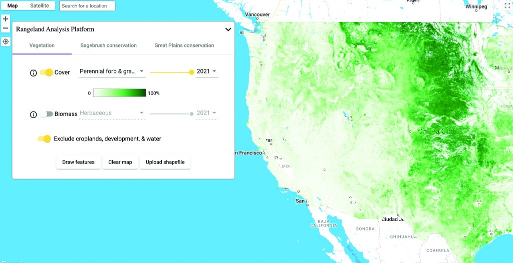
Rangeland Analysis Platform
RAP quickly visualizes and analyzes vegetation data for the United States. You can use the tool to quickly analyze trends at the pasture, ranch, watershed or beyond. Drawing on satellite data from U.S. agencies, RAP can provide insight into changes in biomass production both historically and for the current growing season on a 16-day interval.
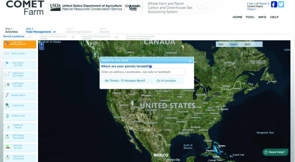
COMET-Planner and COMET-Farm
COMET-Planner is a quick and dirty evaluation tool designed to provide generalized estimates of the greenhouse gas impacts of NRCS conservation practices, limited to those that have been identified as having mitigation or sequestration benefits. COMET-Farm is a whole farm and ranch carbon and greenhouse gas accounting system. The tool guides you through describing your farm and ranch management practices including alternative future management scenarios. Once complete, it generates a report comparing the carbon changes and greenhouse gas emissions of your current management practices and future scenarios. Both tools are maintained through a partnership between NRCS and Colorado State University.
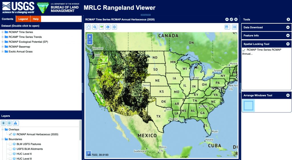
USGS Rangeland Condition, Monitoring, Assessment and Projection (RCMAP)
Provided by USGS’s Earth Resources Observation and Science Center, this tool is designed to characterize the landscapes of the West in units of percent coverage (0-100%) for each “building block” component of rangeland ecosystems: shrub, sagebrush, bare ground, herbaceous, annual herbaceous and litter. RCMAP also provides trends over time for each component. These two factors make RCMAP well-suited to guide research, land management and conservation decisions across the West.
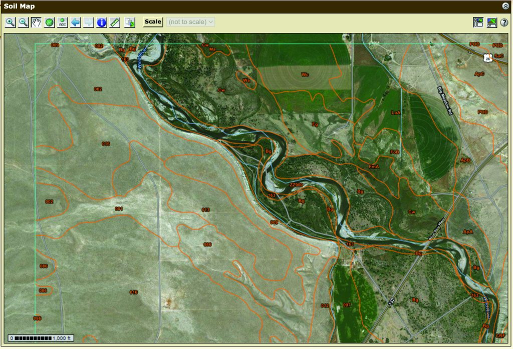
NRCS Web Soil Survey
Web Soil Survey (WSS) provides soil data and information produced by the National Cooperative Soil Survey. It is operated by the USDA Natural Resources Conservation Service (NRCS) and provides access to the largest natural resource information system in the world. NRCS has soil maps and data available online for more than 95 percent of the nation’s counties and anticipates having 100 percent in the near future. The site is updated and maintained online as the single authoritative source of soil survey information.